Burgabo (Buur Gaabo)
Burgabo (Buur Gaabo) is a port town in Lower Jubba province in southern Somalia near the border with Kenya. Other names and variants of the town include Berikau, Bircao, Birikao, Birikau, Bur Gabo, Bur Gao, Bur Gavo, Hohenzollernhafen, Port Dunford, Port Durnford and Wubushi.
Burgabo lies at the mouth of the Burgabo River and is connected via a dirt road to Kamboni, the southernmost town in Somalia, 55 km away at the Kenyan border. The connections with the sparsely populated inland and towards the north consist of barely accessible paths. The district capital Badhaadhe lies 43 km to the northwest. Offshore are reefs and the Bajuni Islands, which extend northeastward to Kismayo.
On the northern edge of the town, there are extensive charcoal storage sites; charcoal is produced in the hinterland and exported from Burgabo to the Arabian Peninsula via dhow. This export is banned by the United Nations Security Council because the Islamic terror group Al-Shabaab is financed by the proceeds.
Burgabo has a tropical savanna climate with an average annual temperature of 27.2 °C. The hottest month is April with an average of 28.8 °C; the coolest month is July, averaging 25.6 °C. The annual precipitation amounts to approximately 474 mm. The dry season is from January to March, followed by a rainy season from April to July. After that, rainfall regularly falls with a small peak in October. The wettest month is May when there is then about 130 mm, more than a quarter of the annual total. The annual fluctuations can also be considerable.
Map - Burgabo (Buur Gaabo)
Map
Country - Somalia
 |
 |
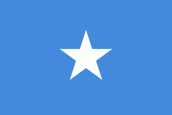
| Flag of Somalia | |
In antiquity, Somalia was an important commercial center. It is among the most probable locations of the ancient Land of Punt. During the Middle Ages, several powerful Somali empires dominated the regional trade, including the Ajuran Sultanate, the Adal Sultanate, and the Sultanate of the Geledi.
Currency / Language
| ISO | Currency | Symbol | Significant figures |
|---|---|---|---|
| SOS | Somali shilling | Sh | 2 |
| ISO | Language |
|---|---|
| AR | Arabic language |
| EN | English language |
| IT | Italian language |
| SO | Somali language |


